National Institute of Informatics - Digital Silk Road Project
| |||||||||
|
| Scientific Results of a Journey in Central Asia, 1899-1902 : vol.1 |
 |
| At-pangsa, Sept. 21. |
18 THE TARIM RIVER.
partly upon an accession of water from the mountains and partly upon the distribution of the atmospheric pressure over the lowlands.
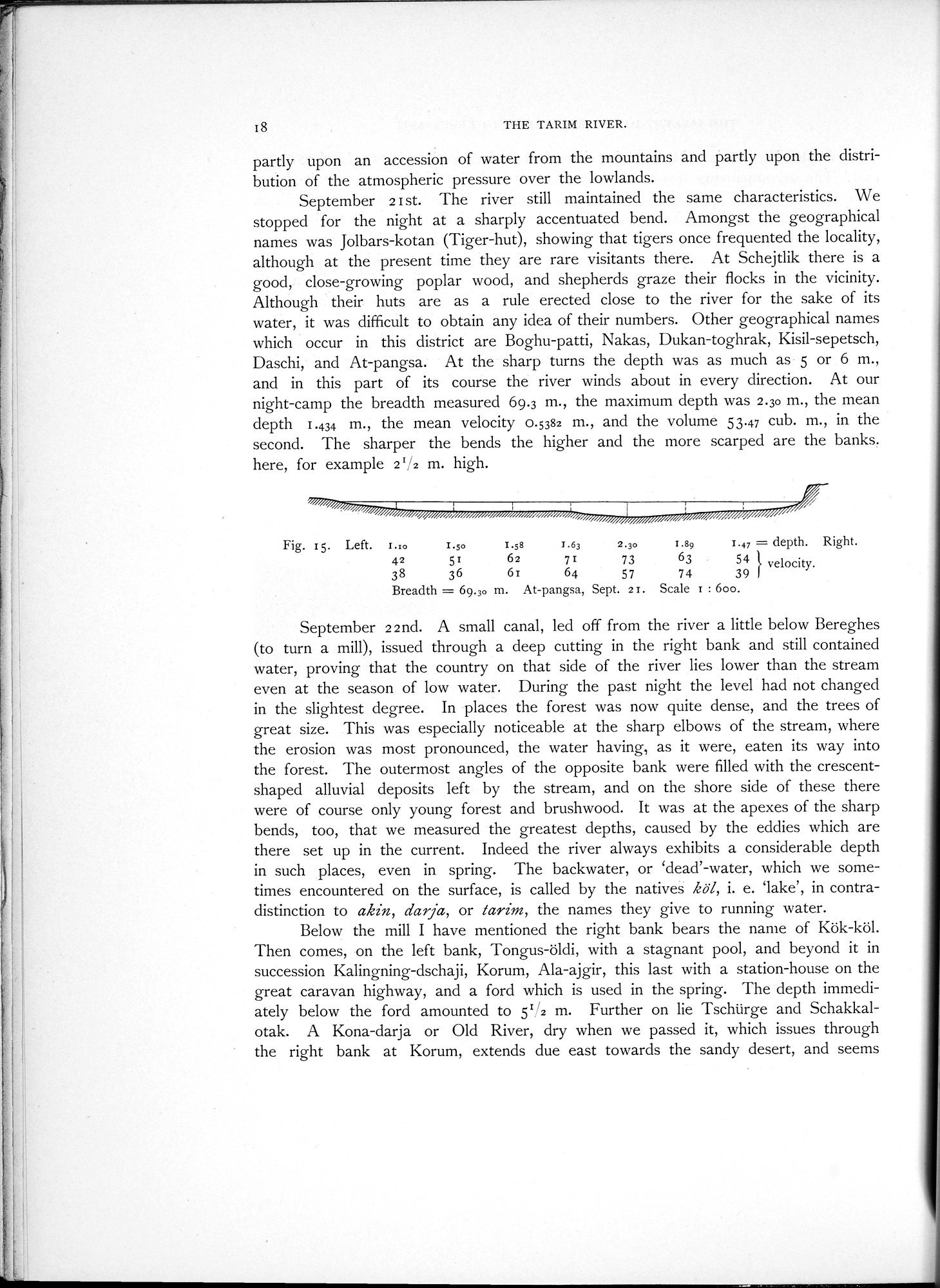
September 2 I st. The river still maintained the same characteristics. We stopped for the night at a sharply accentuated bend. Amongst the geographical names was Jolbars-kotan (Tiger-hut), showing that tigers once frequented the locality, although at the present time they are rare visitants there. At Schejtlik there is a good, close-growing poplar wood, and shepherds graze their flocks in the vicinity. Although their huts are as a rule erected close to the river for the sake of its water, it was difficult to obtain any idea of their numbers. Other geographical names which occur in this district are Boghu-patti, Nakas, Dukan-toghrak, Kisil-sepetsch, Daschi, and At-pangsa. At the sharp turns the depth was as much as 5 or 6 m., and in this part of its course the river winds about in every direction. At our night-camp the breadth measured 69.3 m., the maximum depth was 2.30 m., the mean depth 1.434 m., the mean velocity 0.5382 m., and the volume 53.47 cub. m., in the second. The sharper the bends the higher and the more scarped are the banks. here, for example 21/2 m. high.
Fig. 15. Left. z.:o 1.50 1.58 1.63 2.30 1.89 1.47 = depth. Right.
42 51 62 71 73 63 54 velocity.
38 36 6i 64 57 74 39
Breadth = 69.30 m. At-pangsa, Sept. 2 r. Scale r : 600.
September 22nd. A small canal, led off from the river a little below Bereghes (to turn a mill), issued through a deep cutting in the right bank and still contained water, proving that the country on that side of the river lies lower than the stream even at the season of low water. During the past night the level had not changed in the slightest degree. In places the forest was now quite dense, and the trees of great size. This was especially noticeable at the sharp elbows of the stream, where the erosion was most pronounced, the water having, as it were, eaten its way into the forest. The outermost angles of the opposite bank were filled with the crescent-shaped alluvial deposits left by the stream, and on the shore side of these there were of course only young forest and brushwood. It was at the apexes of the sharp bends, too, that we measured the greatest depths, caused by the eddies which are there set up in the current. Indeed the river always exhibits a considerable depth in such places, even in spring. The backwater, or `dead'-water, which we sometimes encountered on the surface, is called by the natives köl, i. e. `lake', in contradistinction to akin, darja, or Tarim, the names they give to running water.
Below the mill I have mentioned the right bank bears the name of Kök-köl. Then comes, on the left bank, Tongus-öldi, with a stagnant pool, and beyond it in succession Kalingning-dschaji, Korum, Ala-ajgir, this last with a station-house on the great caravan highway, and a ford which is used in the spring. The depth immediately below the ford amounted to 51/2 m. Further on lie Tschürge and Schakkalotak. A Kona-darja or Old River, dry when we passed it, which issues through the right bank at Korum, extends due east towards the sandy desert, and seems
|
Copyright (C) 2003-2019 National Institute of Informatics and The Toyo Bunko. All Rights Reserved.