National Institute of Informatics - Digital Silk Road Project
| |||||||||
|
| Scientific Results of a Journey in Central Asia, 1899-1902 : vol.1 |
 |
| A threshold. |
360 THE TSCHERTSCI-IEN DESERT.
Thus there are numerous departures from the type of normal and continuous wave-crests, as caused by the varying rates at which different parts of the dune-walls advance.
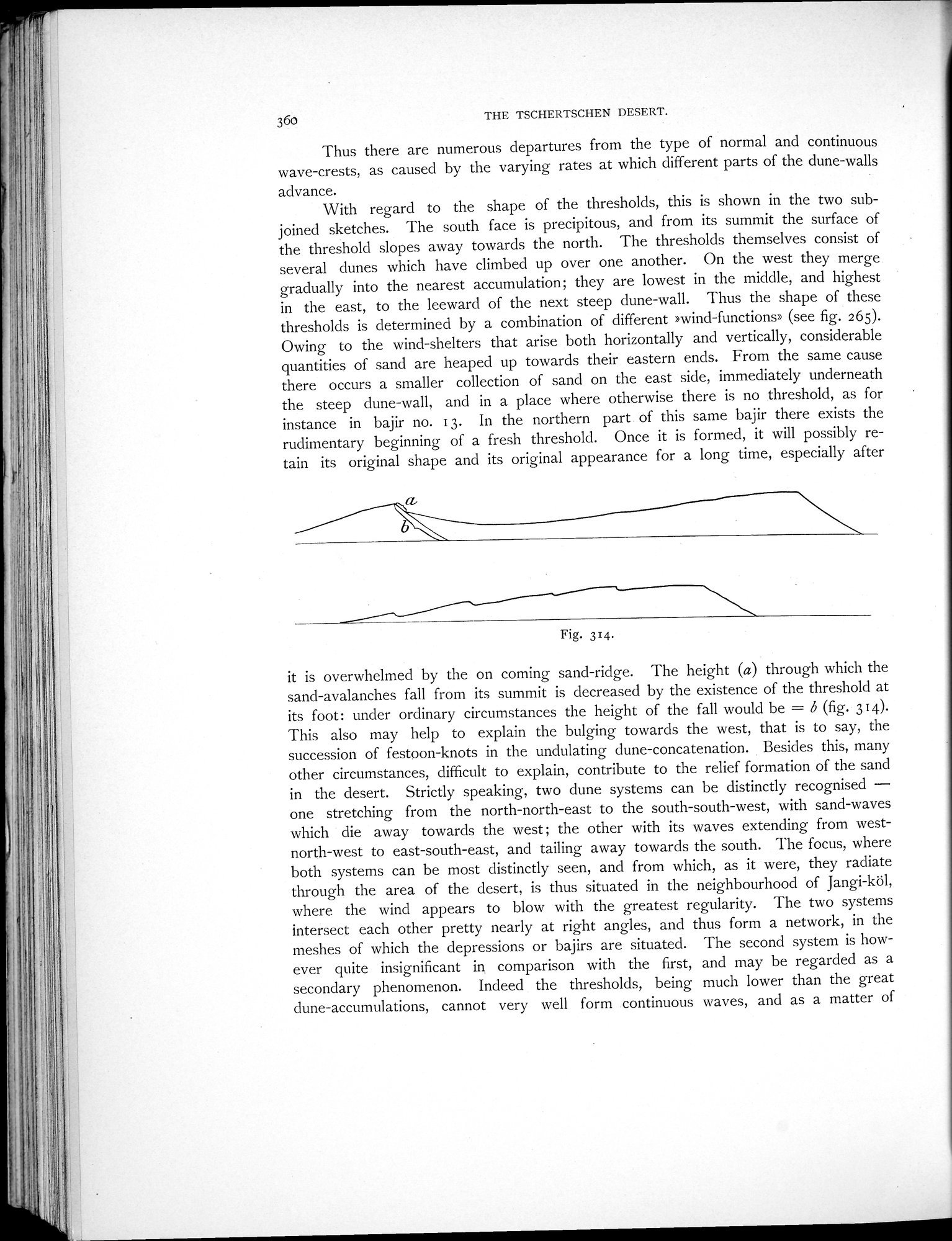
With regard to the shape of the thresholds, this is shown in the two subjoined sketches. The south face is precipitous, and from its summit the surface of the threshold slopes away towards the north. The thresholds themselves consist of several dunes which have climbed up over one another. On the west they merge gradually into the nearest accumulation; they are lowest in the middle, and highest in the east, to the leeward of the next steep dune-wall. Thus the shape of these thresholds is determined by a combination of different »wind-functions» (see fig. 265). Owing to the wind-shelters that arise both horizontally and vertically, considerable quantities of sand are heaped up towards their eastern ends. From the same cause there occurs a smaller collection of sand on the east side, immediately underneath the steep dune-wall, and in a place where otherwise there is no threshold, as for instance in bajir no. 13. In the northern part of this same bajir there exists the rudimentary beginning of a fresh threshold. Once it is formed, it will possibly retain its original shape and its original appearance for a long time, especially after
Fig. 314.
it is overwhelmed by the on coming sand-ridge. The height (a) through which the sand-avalanches fall from its summit is decreased by the existence of the threshold at its foot: under ordinary circumstances the height of the fall would be = b (fig. 314). This also may help to explain the bulging towards the west, that is to say, the succession of festoon-knots in the undulating dune-concatenation. Besides this, many other circumstances, difficult to explain, contribute to the relief formation of the sand in the desert. Strictly speaking, two dune systems can be distinctly recognised — one stretching from the north-north-east to the south-south-west, with sand-waves which die away towards the west ; the other with its waves extending from west-north-west to east-south-east, and tailing away towards the south. The focus, where both systems can be most distinctly seen, and from which, as it were, they radiate through the area of the desert, is thus situated in the neighbourhood of Jangi-köl, where the wind appears to blow with the greatest regularity. The two systems intersect each other pretty nearly at right angles, and thus form a network, in the meshes of which the depressions or bajirs are situated. The second system is however quite insignificant in comparison with the first, and may be regarded as a secondary phenomenon. Indeed the thresholds, being much lower than the great dune-accumulations, cannot very well form continuous waves, and as a matter of
|
Copyright (C) 2003-2019 National Institute of Informatics and The Toyo Bunko. All Rights Reserved.