National Institute of Informatics - Digital Silk Road Project
| |||||||||
|
| Scientific Results of a Journey in Central Asia, 1899-1902 : vol.1 |
 |
| THE KUNTSCHEKISCH-TARIM AT APIS-ANGESI; IN WINTER THE WATER FALLEN CONSIDERABLY AND THEREFORE THE SURFACE OF THE ICE IS CONCAVE. |
TI-IE RETURN JOURNEY FROM ARGHAN TO JANGI-KOL. 431
tschatsch branch stands the village of Tschigelik, a kischlak, or »winter village», with 3o ujlik, the summer quarters (jaslak utturghan) of its people being at Kusch.
Then for a considerable distance we travelled across a wide-spread overflow region, manifestly once a lake-basin. In one place we perceived signs of cultivation, and indeed it was only given up two years ago. Further on we encountered two huge patches of ice, backed on the north by bare sand of considerable dimensions. The cause of the district being inundated is a canal which was originally constructed for the purpose of watering the fields in question; but nobody has now any interest in stopping it up, and so preventing the inundations. The two sheets of ice I have just alluded to are called Davaning-köli, a name which points to the presence of a former lake. A strip of sand to the west of them is known as Davan, or the Pass.
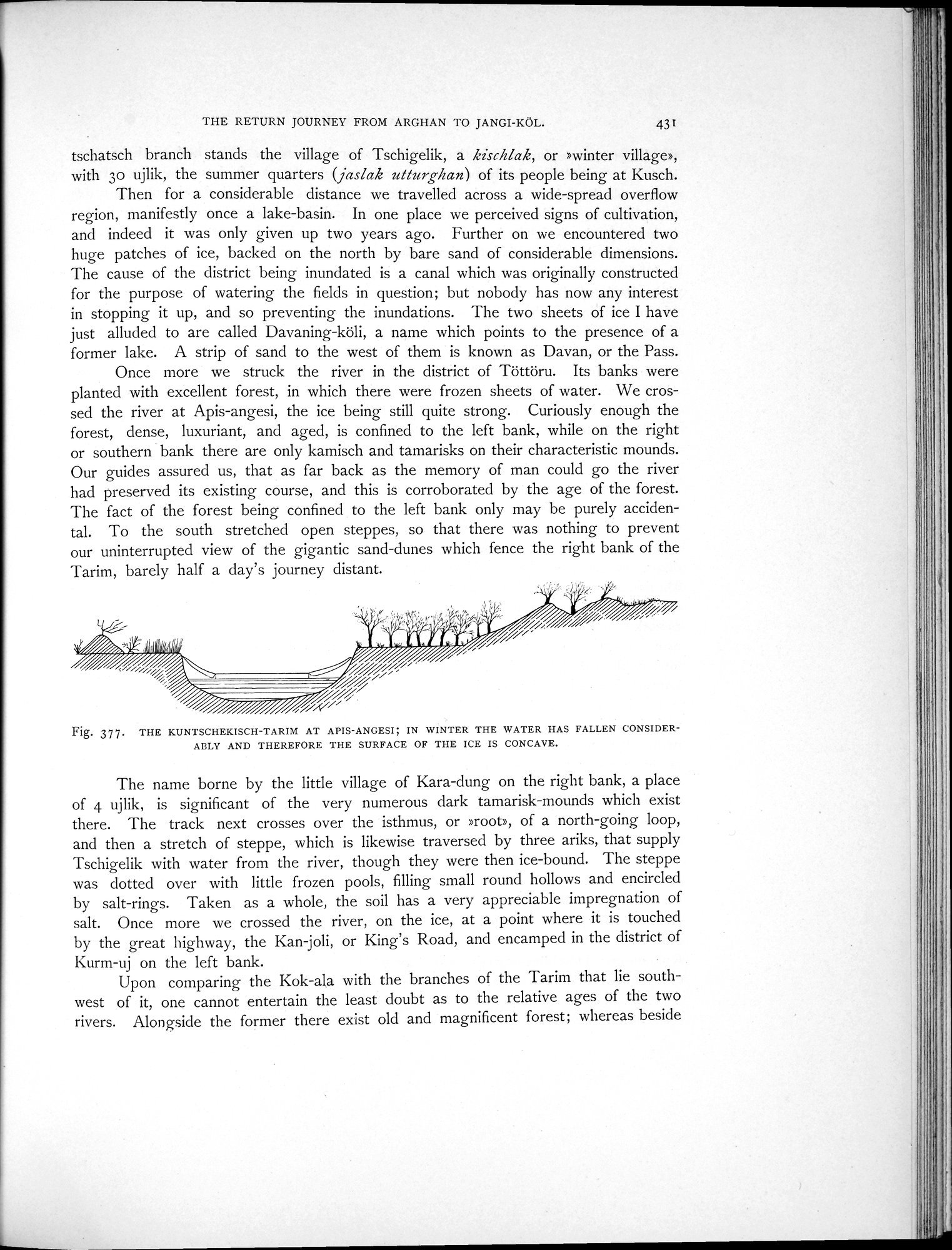
Once more we struck the river in the district of Töttöru. Its banks were planted with excellent forest, in which there were frozen sheets of water. We crossed the river at Apis-angesi, the ice being still quite strong. Curiously enough the forest, dense, luxuriant, and aged, is confined to the left bank, while on the right or southern bank there are only kamisch and tamarisks on their characteristic mounds. Our guides assured us, that as far back as the memory of man could go the river had preserved its existing course, and this is corroborated by the age of the forest. The fact of the forest being confined to the left bank only may be purely accidental. To the south stretched open steppes, so that there was nothing to prevent our uninterrupted view of the gigantic sand-dunes which fence the right bank of the Tarim, barely half a day's journey distant.
Fig. 377. THE KUNTSCHEKISCH-TARIM AT APIS-ANGES!; IN WINTER THE WATER HAS FALLEN CONSIDERABLY AND THEREFORE THE SURFACE OF THE ICE IS CONCAVE.
The name borne by the little village of Kara-dung on the right bank, a place of 4 ujlik, is significant of the very numerous dark tamarisk-mounds which exist there. The track next crosses over the isthmus, or »root», of a north-going loop, and then a stretch of steppe, which is likewise traversed by three ariks, that supply Tschigelik with water from the river, though they were then ice-bound. The steppe was dotted over with little frozen pools, filling small round hollows and encircled by salt-rings. Taken as a whole, the soil has a very appreciable impregnation of salt. Once more we crossed the river, on the ice, at a point where it is touched by the great highway, the Kan joli, or King's Road, and encamped in the district of Kurm-uj on the left bank.
Upon comparing the Kok-ala with the branches of the Tarim that lie southwest of it, one cannot entertain the least doubt as to the relative ages of the two rivers. Alongside the former there exist old and magnificent forest; whereas beside
|
Copyright (C) 2003-2019 National Institute of Informatics and The Toyo Bunko. All Rights Reserved.