National Institute of Informatics - Digital Silk Road Project
| |||||||||
|
| Scientific Results of a Journey in Central Asia, 1899-1902 : vol.1 |
 |
| Läschlik, Sept. 27. | |
| Jalghus-jigde, Sept. 28. |
26
THE TARIM RIVER.
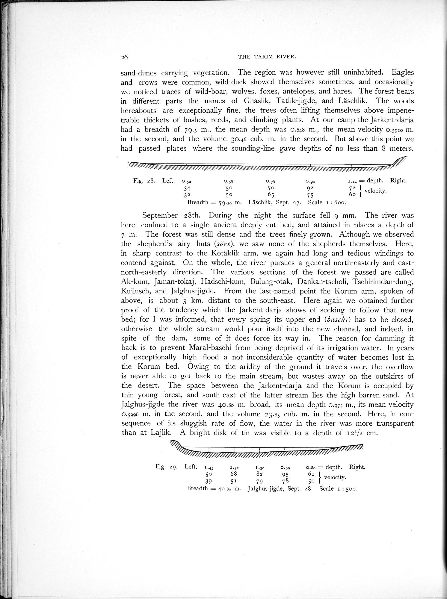
sand-dunes carrying vegetation. The region was however still uninhabited. Eagles and crows were common, wild-duck showed themselves sometimes, and occasionally we noticed traces of wild-boar, wolves, foxes, antelopes, and hares. The forest bears in different parts the names of Ghaslik, Tatlik jigde, and Läschlik. The woods hereabouts are exceptionally fine, the trees often lifting themselves above impenetrable thickets of bushes, reeds, and climbing plants. At our camp the Jarkent-darja had a breadth of 79.5 m., the mean depth was 0.648 m., the mean velocity 0.5910 m. in the second, and the volume 30.46 cub. M. in the second. But above this point we had passed places where the sounding-line gave depths of no less than 8 meters.
Fig. 28. Left. 0.52 o.ss 0.78 0.90 I.:: = depth. Right.
34 50 70 92 7z velocity.
32 50 65 75 60
Breadth = 79.50 m. Lâschlik, Sept. 27. Scale i : 600.
September 28th. During the night the surface fell 9 mm. The river was here confined to a single ancient deeply cut bed, and attained in places a depth of 7 m. The forest was still dense and the trees finely grown. Although we observed the shepherd's airy huts (sore), we saw none of the shepherds themselves. Here, in sharp contrast to the Kötäklik arm, we again had long and tedious windings to contend against. On the whole, the river pursues a general north-easterly and east-north-easterly direction. The various sections of the forest we passed are called Ak-kum, Jaman-tokaj, Hadschi-kum, Bulung-otak, Dankan-tscholi, Tschirimdan-dung, Kujlusch, and Jalghus-jigde. From the last-named point the Korum arm, spoken of above, is about 3 km. distant to the south-east. Here again we obtained further proof of the tendency which the Jarkent-darja shows of seeking to follow that new bed; for I was informed, that every spring its upper end (baschz) has to be closed, otherwise the whole stream would pour itself into the new channel, and indeed, in spite of the dam, some of it does force its way in. The reason for damming it back is to prevent Maral-baschi from being deprived of its irrigation water. In years of exceptionally high flood a not inconsiderable quantity of water becomes lost in the Korum bed. Owing to the aridity of the ground it travels over, the overflow is never able to get back to the main stream, but wastes away on the outskirts of the desert. The space between the Jarkent-darja and the Korum is occupied by thin young forest, and south-east of the latter stream lies the high barren sand. At Jalghus jigde the river was 40.80 m. broad, its mean depth 0.975 m., its mean velocity 0.5996 m. in the second, and the volume 23.85 cub. m. in the second. Here, in consequence of its sluggish rate of flow, the water in the river was more transparent than at Lajlik. A bright disk of tin was visible to a depth of 121/2 cm.
Fig. 29. Left. 1.45 1.3= 1.30 0.99 0.130 = depth. Right.
50 68 82 95 61 velocity.
39 51 79 78 50
Breadth = 40.80 m. Jalghus-jigde, Sept. 28. Scale 1 : 500.
|
Copyright (C) 2003-2019 National Institute of Informatics and The Toyo Bunko. All Rights Reserved.