National Institute of Informatics - Digital Silk Road Project
| |||||||||
|
| Scientific Results of a Journey in Central Asia, 1899-1902 : vol.1 |
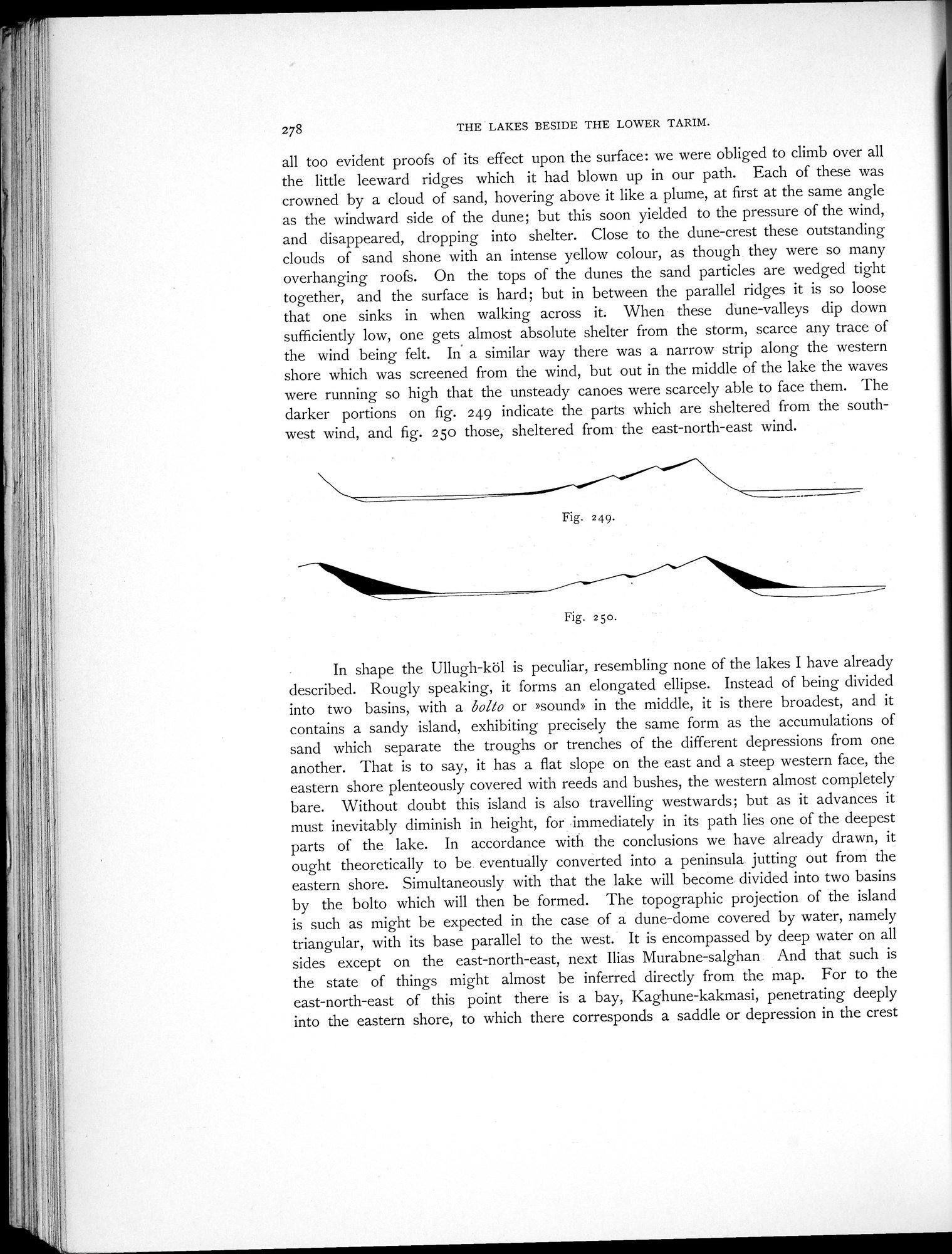 |
| Parts of a dune-accumulation, sheltered from the SW. wind. | |
| Parts of a dune-accumulation, sheltered from the ENE. wind. |
278 THE LAKES BESIDE THE LOWER TARIM.
all too evident proofs of its effect upon the surface: we were obliged to climb over all the little leeward ridges which it had blown up in our path. Each of these was crowned by a cloud of sand, hovering above it like a plume, at first at the same angle as the windward side of the dune; but this soon yielded to the pressure of the wind, and disappeared, dropping into shelter. Close to the dune-crest these outstanding clouds of sand shone with an intense yellow colour, as though they were so many overhanging roofs. On the tops of the dunes the sand particles are wedged tight together, and the surface is hard; but in between the parallel ridges it is so loose that one sinks in when walking across it. When these dune-valleys dip down sufficiently low, one gets almost absolute shelter from the storm, scarce any trace of the wind being felt. In a similar way there was a narrow strip along the western shore which was screened from the wind, but out in the middle of the lake the waves were running so high that the unsteady canoes were scarcely able to face them. The darker portions on fig. 249 indicate the parts which are sheltered from the southwest wind, and fig. 25o those, sheltered from the east-north-east wind.
Fig. 249.
Fig. 2 5o.
In shape the Ullugh-köl is peculiar, resembling none of the lakes I have already described. Rougly speaking, it forms an elongated ellipse. Instead of being divided into two basins, with a bolto or »sound» in the middle, it is there broadest, and it contains a sandy island, exhibiting precisely the same form as the accumulations of sand which separate the troughs or trenches of the different depressions from one another. That is to say, it has a flat slope on the east and a steep western face, the eastern shore plenteously covered with reeds and bushes, the western almost completely bare. Without doubt this island is also travelling westwards; but as it advances it must inevitably diminish in height, for immediately in its path lies one of the deepest parts of the lake. In accordance with the conclusions we have already drawn, it ought theoretically to be eventually converted into a peninsula jutting out from the eastern shore. Simultaneously with that the lake will become divided into two basins by the bolto which will then be formed. The topographic projection of the island is such as might be expected in the case of a dune-dome covered by water, namely triangular, with its base parallel to the west. It is encompassed by deep water on all sides except on the east-north-east, next Ilias Murabne-salghan And that such is the state of things might almost be inferred directly from the map. For to the east-north-east of this point there is a bay, Kaghune-kakmasi, penetrating deeply into the eastern shore, to which there corresponds a saddle or depression in the crest
|
Copyright (C) 2003-2019 National Institute of Informatics and The Toyo Bunko. All Rights Reserved.