National Institute of Informatics - Digital Silk Road Project
| |||||||||
|
| Scientific Results of a Journey in Central Asia, 1899-1902 : vol.1 |
 |
| Matan, October 23. |
64 THE TARIM RIVER.
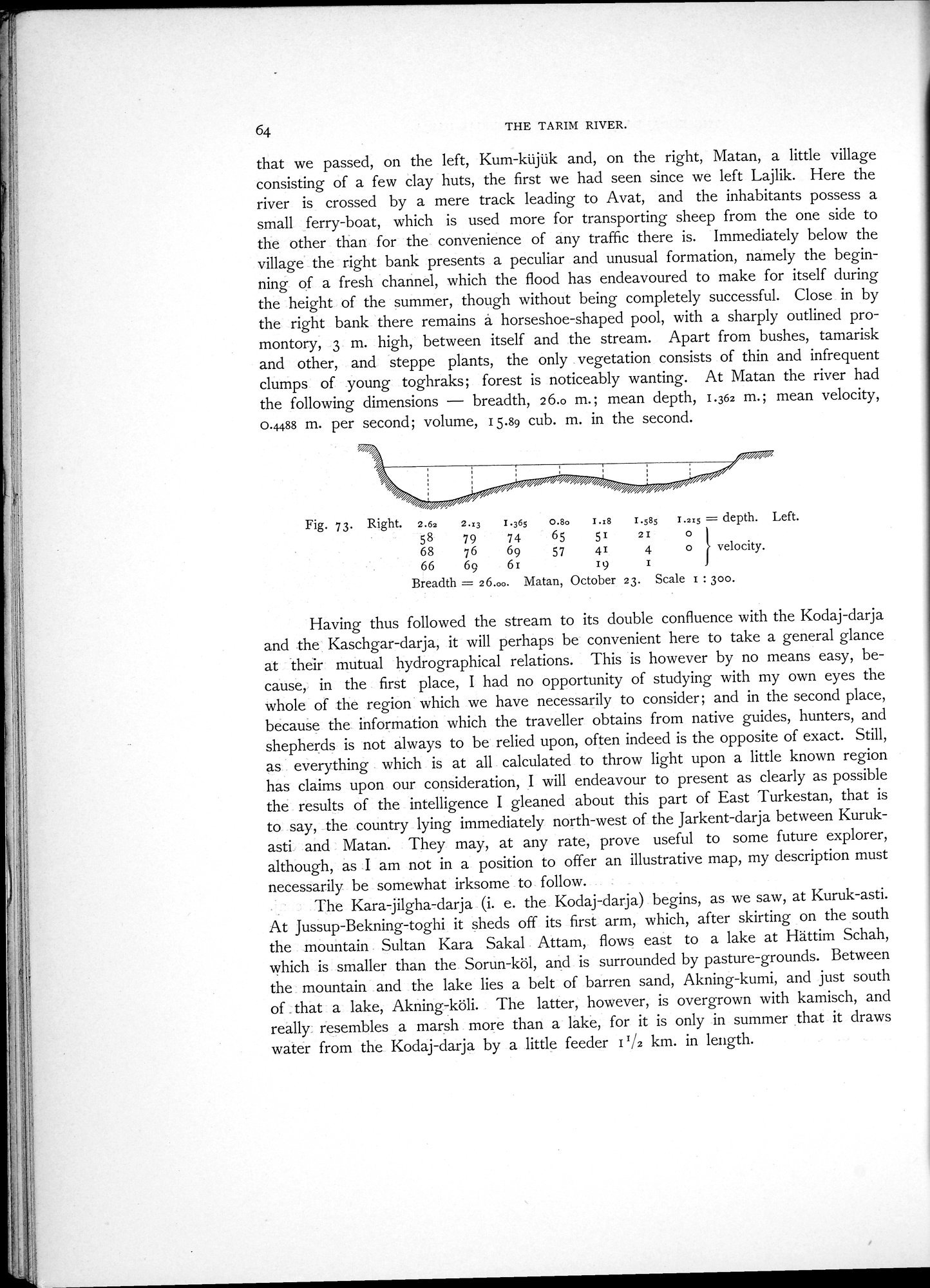
that we passed, on the left, Kum-küjük and, on the right, Matan, a little village consisting of a few clay huts, the first we had seen since we left Lajlik. Here the river is crossed by a mere track leading to Avat, and the inhabitants possess a small ferry-boat, which is used more for transporting sheep from the one side to the other than for the convenience of any traffic there is. Immediately below the village the right bank presents a peculiar and unusual formation, namely the beginning of a fresh channel, which the flood has endeavoured to make for itself during the height of the summer, though without being completely successful. Close in by the right bank there remains A horseshoe-shaped pool, with a sharply outlined promontory, 3 m. high, between itself and the stream. Apart from bushes, tamarisk and other, and steppe plants, the only vegetation consists of thin and infrequent clumps of young toghraks; forest is noticeably wanting. At Matan the river had the following dimensions — breadth, 2 6.0 m.; mean depth, 1.362 m.; mean velocity, 0.4488 m. per second; volume, 15.89 cub. m. in the second.
Fig. 73. Right. 2.63 2.:g 1.365 0.80 I.:s I.SSS 1..215 =depth. Left.
58 79 74 65 51 21 0
68 76 69 57 41 4 0 velocity.
66 69 61 19 I
Breadth = 26.00. Matan, October 23. Scale 1 : 300.
Having thus followed the stream to its double confluence with the Kodaj-darja and the Kaschgar-darja, it will perhaps be convenient here to take a general glance at their mutual hydrographical relations. This is however by no means easy, because, in the first place, I had no opportunity of studying with my own eyes the whole of the region which we have necessarily to consider; and in the second place, because the information which the traveller obtains from native guides, hunters, and shepherds is not always to be relied upon, often indeed is the opposite of exact. Still, as everything which is at all calculated to throw light upon a little known region has claims upon our consideration, I will endeavour to present as clearly as possible the results of the intelligence I gleaned about this part of East Turkestan, that is to say, the country lying immediately north-west of the Jarkent-darja between Kurukasti and Matan. They may, at any rate, prove useful to some future explorer, although, as I am not in a position to offer an illustrative map, my description must necessarily be somewhat irksome to follow.
The Kara-jilgha-darja (i. e. the Kodaj-darja) begins, as we saw, at Kuruk-asti. At Jussup-Bekning-toghi it sheds off its first arm, which, after skirting on the south the mountain Sultan Kara Sakal Attam, flows east to a lake at Hättim Schah, which is smaller than the Sorun-köl, and is surrounded by pasture-grounds. Between the mountain and the lake lies a belt of barren sand, Akning-kumi, and just south of . that a lake, Akning-köli. The latter, however, is overgrown with kamisch, and really resembles a marsh more than a lake, for it is only in summer that it draws water from the Kodaj-darja by a little feeder 11/2 km. in length.
|
Copyright (C) 2003-2019 National Institute of Informatics and The Toyo Bunko. All Rights Reserved.