National Institute of Informatics - Digital Silk Road Project
| |||||||||
|
| Scientific Results of a Journey in Central Asia, 1899-1902 : vol.1 |
 |
| Tarim at Schirge-tschapghan, June 10. | |
| Lower channel of Schirge-tschapghan, June 10. |
FROM AJAGH-ARGHAN TO JURT-TSCHAPGHAN. 215
mean depth, 2.491 • m.; mean velocity, 0.8590 m.: and volume, 101 .86 cub.m. in the second. Deducting from this the volume of the upper kok-ala, 2.44 cub.m., we have left 99.42 cub.m., which was the true datum for the river. The total contributions of the Kara-köl system amounted on the 18th April to 5.15 cub.m.; so that the river below its outfall had a volume of 107.01 cub.m., or 21 cub.m. more than at Jurttschapghan a short distance lower down a few days later. Hence, notwithstanding the influx from the Tschertschen-darja, the loss of water in this short stretch was very considerable indeed. It is possible, that a wave of ice-water just happened to pass Shirge-tschapghan on the 19th April; in that case it would soon afterwards make its influence felt at Jurt-tschapghan also. If this explanation is not sound, then the great loss of volume must be ascribed to the Kara-buran and the other lakes in its vicinity, where there is excessive evaporation.
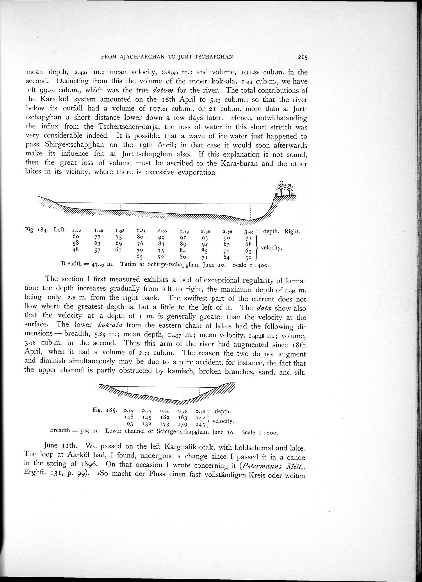
Fig. 184. Left. 1.20 1.46
69 77
58 63
48 57
Breadth = 47.23 m.
1.58 1.83 2.00 2.:9 2.36 2.76 3.49 = depth. Right.
75 8o 99 91 95 90 71
76 84 89 92 85 68 velocity.
69
61 7o 75 84 85 72 63
65 72 8o 71 64 5o
Tarim at Schirge-tschapghan, June lo. Scale i : 400.
The section I first measured exhibits a bed of exceptional regularity of formation: the depth increases gradually from left to right, the maximum depth of 4.34 m. being only 2.6 m. from the right bank. The swiftest part of the current does not flow where the greatest depth is, but a little to the left of it. The data show also that the velocity at a depth of I m. is generally greater than the velocity at the surface. The lower kok-ala from the eastern chain of lakes had the following dimensions - breadth, 5.85 m.; mean depth, 0.457 m.; mean velocity, 1.4148 m.; volume, 3.78 cub.m. in the second. Thus this arm of the river had augmented since 18th April, when it had a volume of 2.71 cub.m. The reason the two do not augment and diminish simultaneously may be due to a pure accident, for instance, the fact that the upper channel is partly obstructed by kamisch, broken branches, sand, and silt.
93 132 173 159 145
Breadth = 5.85 m. Lower channel of Schirge-tschapghan, June io. Scale 1 : 2oo.
June I I th. We passed on the left Karghalik-otak, with boldschemal and lake. The loop at Ak-köl had, I found, undergone a change since I passed it in a canoe in the spring of 1896. On that occasion I wrote concerning it (Petermanns Milt., Erghft. 131, p. 99). »So macht der Fluss einen fast vollständigen Kreis oder weiten
Fig. 185. 0.39 0.49 0.64 0.76 0.46 = depth.
148 145 182 163 142 } velocity.
|
Copyright (C) 2003-2019 National Institute of Informatics and The Toyo Bunko. All Rights Reserved.