National Institute of Informatics - Digital Silk Road Project
| |||||||||
|
| Scientific Results of a Journey in Central Asia, 1899-1902 : vol.1 |
 |
| Vertical section of Tagh-kum. |
408 THE TSCHERTSCHEN DESERT.
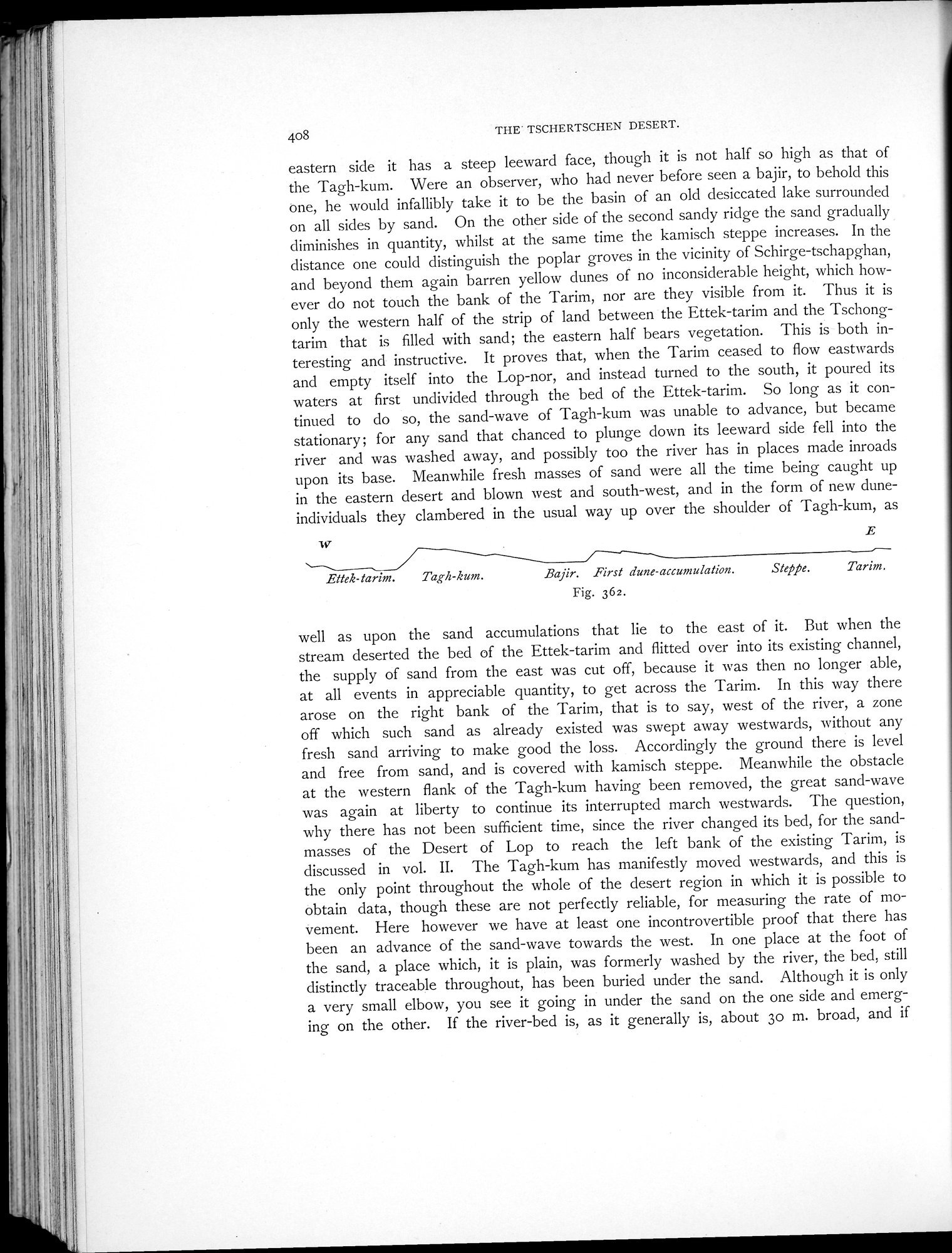
eastern side it has a steep leeward face, though it is not half so high as that of the Tagh-kum. Were an observer, who had never before seen a bajir, to behold this one, he would infallibly take it to be the basin of an old desiccated lake surrounded on all sides by sand. On the other side of the second sandy ridge the sand gradually diminishes in quantity, whilst at the same time the kamisch steppe increases. In the distance one could distinguish the poplar groves in the vicinity of Schirge-tschapghan, and beyond them again barren yellow dunes of no inconsiderable height, which however do not touch the bank of the Tarim, nor are they visible from it. Thus it is only the western half of the strip of land between the Ettek-tarim and the Tschongtarim that is filled with sand; the eastern half bears vegetation. This is both interesting and instructive. It proves that, when the Tarim ceased to flow eastwards and empty itself into the Lop-nor, and instead turned to the south, it poured its waters at first undivided through the bed of the Ettek-tarim. So long as it continued to do so, the sand-wave of Tagh-kum was unable to advance, but became stationary ; for any sand that chanced to plunge down its leeward side fell into the river and was washed away, and possibly too the river has in places made inroads upon its base. Meanwhile fresh masses of sand were all the time being caught up in the eastern desert and blown west and south-west, and in the form of new dune-individuals they clambered in the usual way up over the shoulder of Tagh-kum, as
w E
Ettek-tarin:.
Tagte-kum.
13ajir. First dune-accumulation. Fig. 362.
Steppe.
Tarim.
well as upon the sand accumulations that lie to the east of it. But when the stream deserted the bed of the Ettek-tarim and flitted over into its existing channel, the supply of sand from the east was cut off, because it was then no longer able, at all events in appreciable quantity, to get across the Tarim. In this way there arose on the right bank of the Tarim, that is to say, west of the river, a zone off which such sand as already existed was swept away westwards, without any fresh sand arriving to make good the loss. Accordingly the ground there is level and free from sand, and is covered with kamisch steppe. Meanwhile the obstacle at the western flank of the Tagh-kum having been removed, the great sand-wave was again at liberty to continue its interrupted march westwards. The question, why there has not been sufficient time, since the river changed its bed, for the sand-masses of the Desert of Lop to reach the left bank of the existing Tarim, is discussed in vol. II. The Tagh-kum has manifestly moved westwards, and this is the only point throughout the whole of the desert region in which it is possible to obtain data, though these are not perfectly reliable, for measuring the rate of movement. Here however we have at least one incontrovertible proof that there has been an advance of the sand-wave towards the west. In one place at the foot of the sand, a place which, it is plain, was formerly washed by the river, the bed, still distinctly traceable throughout, has been buried under the sand. Although it is only a very small elbow, you see it going in under the sand on the one side and emerging on the other. If the river-bed is, as it generally is, about 3o m. broad, and if
|
Copyright (C) 2003-2019 National Institute of Informatics and The Toyo Bunko. All Rights Reserved.