National Institute of Informatics - Digital Silk Road Project
| |||||||||
|
| Scientific Results of a Journey in Central Asia, 1899-1902 : vol.1 |
 |
| Al-katik-tscheke, November 26. | |
| THE SAME SECTION OF THE RIVER AT HIGH-WATER STAND. |
136 THE TARIM RIVER.
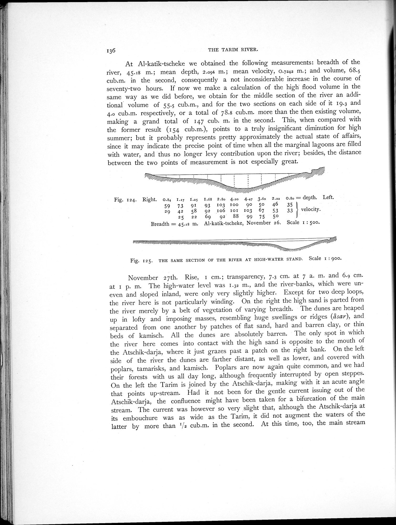
At Al-katik-tscheke we obtained the following measurements: breadth of the river, 45.18 m.; mean depth, 2.094 m.; mean velocity, 0.7242 m.; and volume, 68.5 cub.m. in the second, consequently a not inconsiderable increase in the course of seventy-two hours. If now we make a calculation of the high flood volume in the same way as we did before, we obtain for the middle section of the river an additional volume of 55.5 cub.m., and for the two sections on each side of it 19.3 and 4.0 cub.m. respectively, or a total of 78.8 cub.m. more than the then existing volume, making a grand total of 147 cub. m. in the second. This, when compared with the former result (154 cub.m.), points to a truly insignificant diminution for high summer; but it probably represents pretty approximately the actual state of affairs, since it may indicate the precise point of time when all the marginal lagoons are filled with water, and thus no longer levy contribution upon the river; besides, the distance between the two points of measurement is not especially great.
Fig. I24. Right. 0.84 I..7 I.25 1.68 2.8o 4.20 4.47 3.6o 2.22 0.8o = depth. Left. 59 73 91 93 103 Too 90 5o 46 35
29 42 58 92 Io6 1oi 103 67 53 33 )} velocity.
25 22 69 92 88 99 75 5o
Breadth = 45.i8 m. Al-katik-tscheke, November 26. Scale I : zoo.
Fig. I25. THE SAME SECTION OF THE RIVER AT HIGH-WATER STAND. Scale I : 900.
November 27th. Rise, I cm.; transparency, 7.3 cm. at 7 a. m. and 6.9 cm. at I p. m. The high-water level was 1.32 m., and the river-banks, which were uneven and sloped inland, were only very slightly higher. Except for two deep loops, the river here is not particularly winding. On the right the high sand is parted from the river merely by a belt of vegetation of varying breadth. The dunes are heaped up in lofty and imposing masses, resembling huge swellings or ridges (asar), and separated from one another by patches of flat sand, hard and barren clay, or thin beds of kamisch. All the dunes are absolutely barren. The only spot in which the river here comes into contact with the high sand is opposite to the mouth of the Atschik-darja, where it just grazes past a patch on the right bank. On the left side of the river the dunes are farther distant, as well as lower, and covered with poplars, tamarisks, and kamisch. Poplars are now again quite common, and we had their forests with us all day long, although frequently interrupted by open steppes. On the left the Tarim is joined by the Atschik-darja, making with it an acute angle that points up-stream. Had it not been for the gentle current issuing out of the Atschik-darja, the confluence might have been taken for a bifurcation of the main stream. The current was however so very slight that, although the Atschik-darja at its embouchure was as wide as the Tarim, it did not augment the waters of the latter by more than T/2 cub.m. in the second. At this time, too, the main stream
|
Copyright (C) 2003-2019 National Institute of Informatics and The Toyo Bunko. All Rights Reserved.