National Institute of Informatics - Digital Silk Road Project
| |||||||||
|
| Scientific Results of a Journey in Central Asia, 1899-1902 : vol.1 |
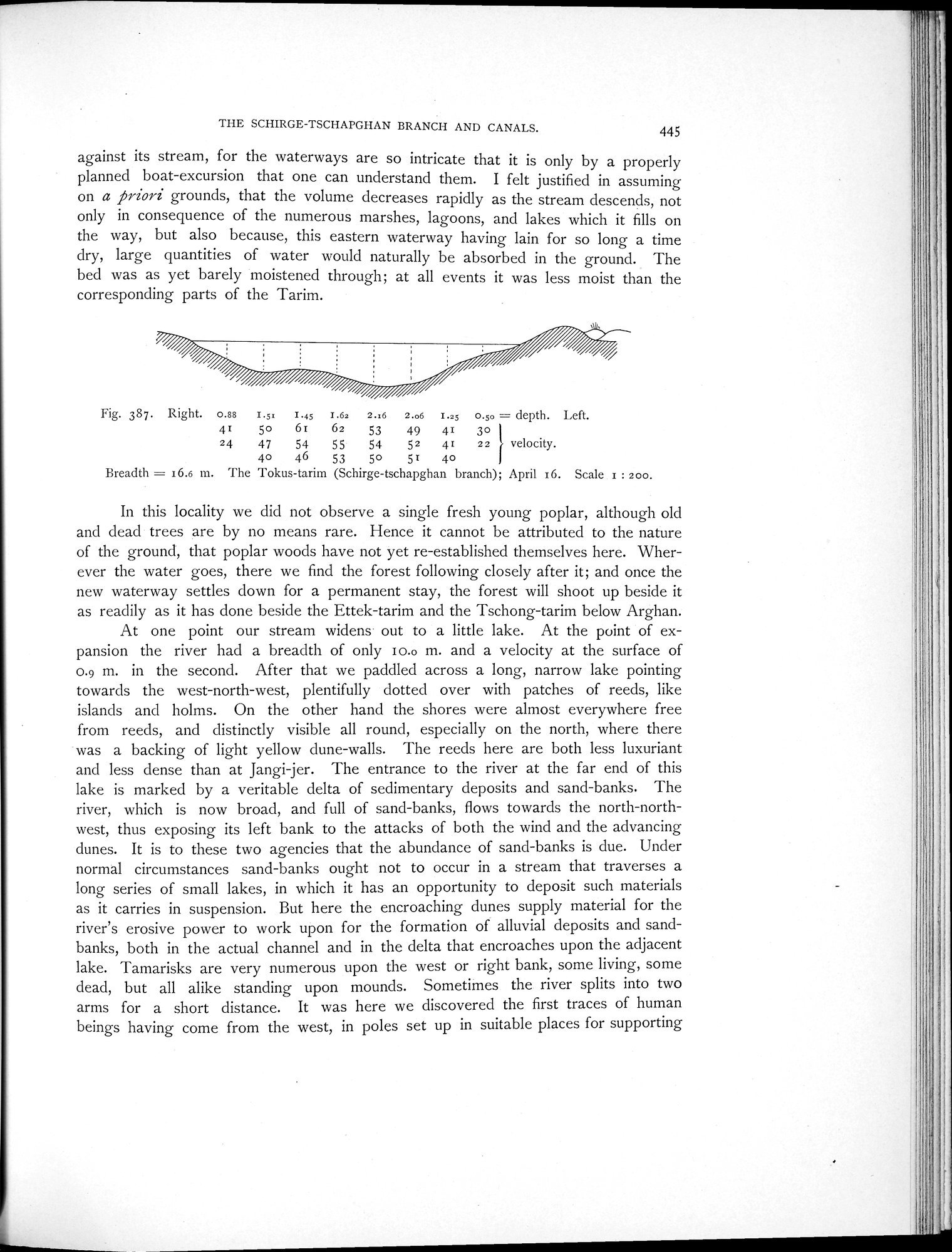 |
| The Tokus-tarim (Schirge-tschapghan branch); April 16. |
THE SCHIRGE-TSCHAPGHAN BRANCH AND CANALS. 445
against its stream, for the waterways are so intricate that it is only by a properly planned boat-excursion that one can understand them. I felt justified in assuming on a priori grounds, that the volume decreases rapidly as the stream descends, not only in consequence of the numerous marshes, lagoons, and lakes which it fills on the way, but also because, this eastern waterway having lain for so long a time dry, large quantities of water would naturally be absorbed in the ground. The bed was as yet barely moistened through; at all events it was less moist than the corresponding parts of the Tarim.
Fig. 387. Right. o.ss 1.5= T. 1.63 2.i6 2.o6 I. o.so 11= depth. Left.
41 50 6i 62 53 49 41 30
24 47 54 55 54 52 41 22 1 velocity.
40 46 53 50 51 40
Breadth = 16.6 m. The Tokus-tarim (Schirge-tschapghan branch); April 16. Scale 1 : 200.
In this locality we did not observe a single fresh young poplar, although old and dead trees are by no means rare. Hence it cannot be attributed to the nature of the ground, that poplar woods have not yet re-established themselves here. Wherever the water goes, there we find the forest following closely after it; and once the new waterway settles down for a permanent stay, the forest will shoot up beside it as readily as it has done beside the Ettek-tarim and the Tschong-tarim below Arghan.
At one point our stream widens- out to a little lake. At the point of expansion the river had a breadth of only I0.o m. and a velocity at the surface of 0.9 m. in the second. After that we paddled across a long, narrow lake pointing towards the west-north-west, plentifully dotted over with patches of reeds, like islands and holms. On the other hand the shores were almost everywhere free from reeds, and distinctly visible all round, especially on the north, where there was a backing of light yellow dune-walls. The reeds here are both less luxuriant and less dense than at Jangi-jer. The entrance to the river at the far end of this lake is marked by a veritable delta of sedimentary deposits and sand-banks. The river, which is now broad, and full of sand-banks, flows towards the north-northwest, thus exposing its left bank to the attacks of both the wind and the advancing dunes. It is to these two agencies that the abundance of sand-banks is due. Under normal circumstances sand-banks ought not to occur in a stream that traverses a long series of small lakes, in which it has an opportunity to deposit such materials as it carries in suspension. But here the encroaching dunes supply material for the river's erosive power to work upon for the formation of alluvial deposits and sandbanks, both in the actual channel and in the delta that encroaches upon the adjacent lake. Tamarisks are very numerous upon the west or right bank, some living, some dead, but all alike standing upon mounds. Sometimes the river splits into two arms for a short distance. It was here we discovered the first traces of human beings having come from the west, in poles set up in suitable places for supporting
|
Copyright (C) 2003-2019 National Institute of Informatics and The Toyo Bunko. All Rights Reserved.