National Institute of Informatics - Digital Silk Road Project
| |||||||||
|
| Scientific Results of a Journey in Central Asia, 1899-1902 : vol.1 |
 |
| HIGH SAND-BANK ON THE RIGHT SIDE OF THE JARKENT-DARJA, SEPT. 25TH. | |
| Töländä, Sept. 24. |
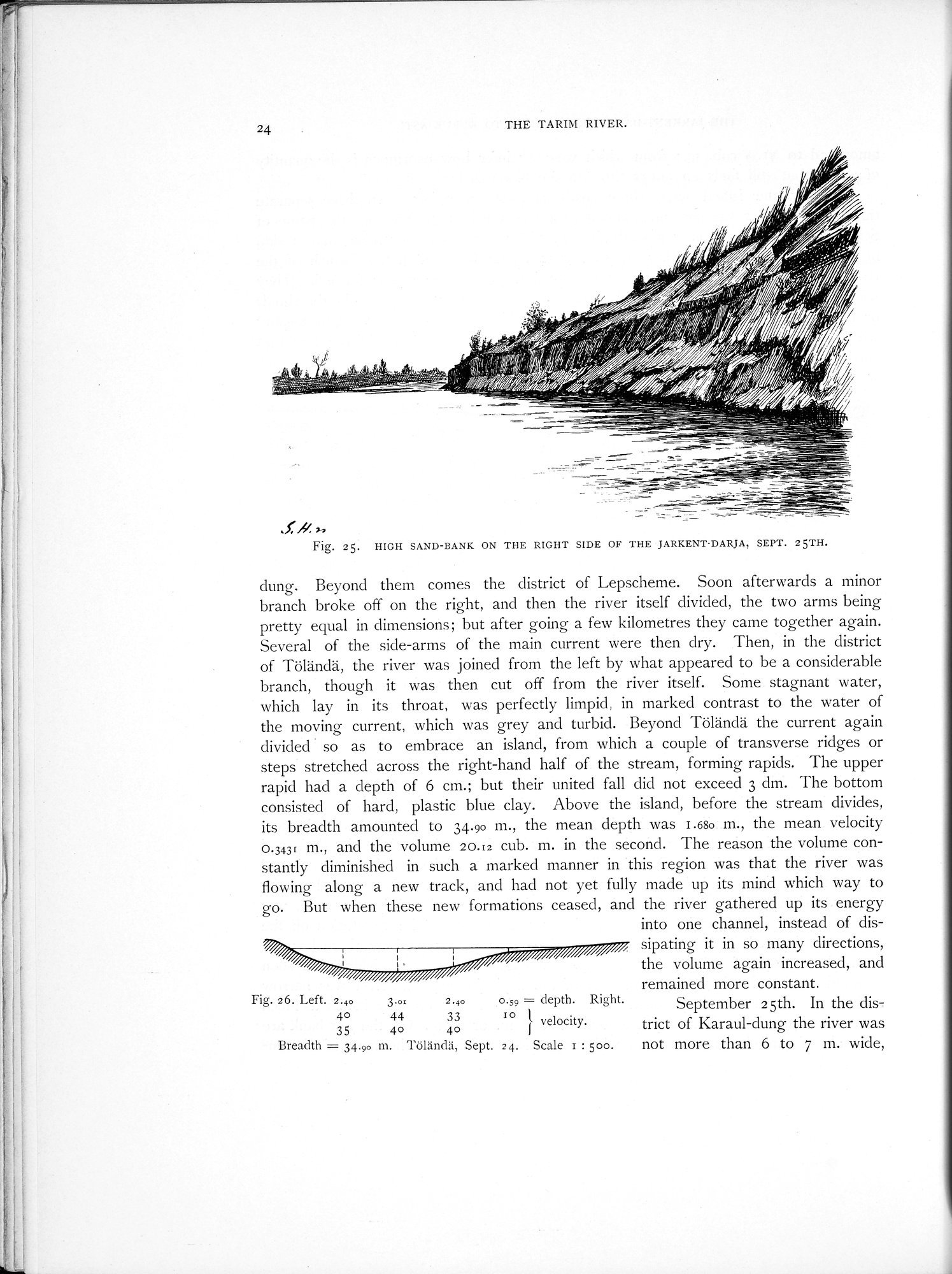
24 THE TARIN RIVER.
Fig. 25. HIGH SAND-BANK ON THE RIGHT SIDE OF THE JARKENT•DARJA, SEPT. 25TH.
dung. Beyond them comes the district of Lepscheme. Soon afterwards a minor branch broke off on the right, and then the river itself divided, the two arms being pretty equal in dimensions; but after going a few kilometres they came together again. Several of the side-arms of the main current were then dry. Then, in the district of Töländä, the river was joined from the left by what appeared to be a considerable branch, though it was then cut off from the river itself. Some stagnant water, which lay in its throat, was perfectly limpid, in marked contrast to the water of the moving current, which was grey and turbid. Beyond Töländä the current again divided • so as to embrace an island, from which a couple of transverse ridges or steps stretched across the right-hand half of the stream, forming rapids. The upper rapid had a depth of 6 cm.; but their united fall did not exceed 3 dm. The bottom consisted of hard, plastic blue clay. Above the island, before the stream divides, its breadth amounted to 34.90 m., the mean depth was 1.680 m., the mean velocity 0.3431 m., and the volume 2o.t2 cub. m. in the second. The reason the volume constantly diminished in such a marked manner in this region was that the river was flowing along a new track, and had not yet fully made up its mind which way to go. But when these new formations ceased, and the river gathered up its energy
into one channel, instead of dis-
,, sipating it in so many directions,
the volume again increased, and
remained more constant.
Fig. 26. Left. 2.40 3.0. 2.40 0.59 = depth. Right. September 25th. In the dis-
40 44 33 Iovelocity. trict of Karaul-dung the river was
35 40 40
Breadth = 34.90 m. Töländä, Sept. 24. Scale r : 500. not more than 6 to 7 m. wide,
|
Copyright (C) 2003-2019 National Institute of Informatics and The Toyo Bunko. All Rights Reserved.