National Institute of Informatics - Digital Silk Road Project
| |||||||||
|
| Scientific Results of a Journey in Central Asia, 1899-1902 : vol.1 |
 |
| Tschertschen-darja, June 21. |
222 THE TARIM RIVER.
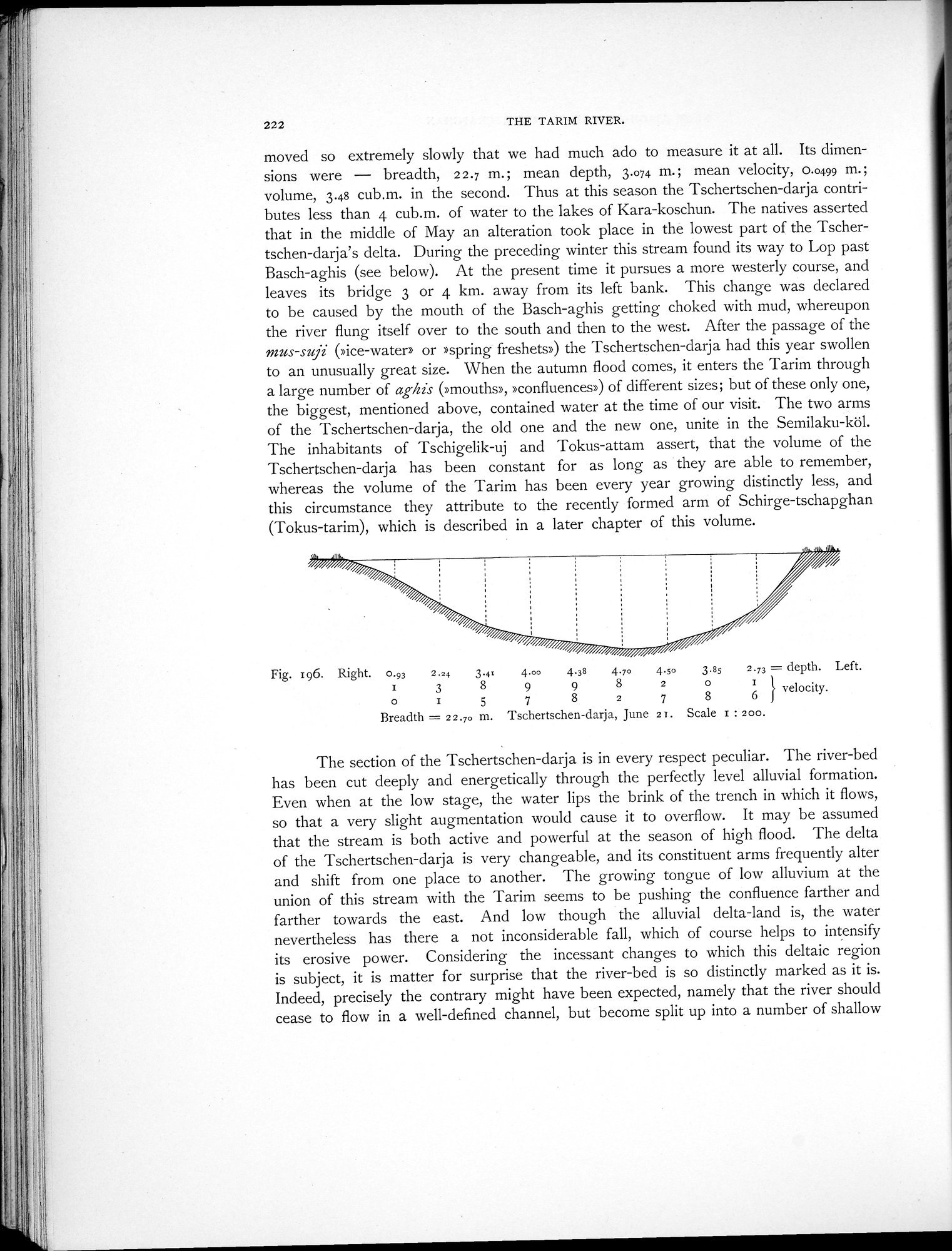
moved so extremely slowly that we had much ado to measure it at all. Its dimensions were — breadth, 22.7 m.; mean depth, 3.o74 m.; mean velocity, 0.0499 m.; volume, 3.48 cub.m. in the second. Thus at this season the Tschertschen-darja contributes less than 4 cub.m. of water to the lakes of Kara-koschun. The natives asserted that in the middle of May an alteration took place in the lowest part of the Tschertschen-darja's delta. During the preceding winter this stream found its way to Lop past Basch-aghis (see below). At the present time it pursues a more westerly course, and leaves its bridge 3 or 4 km. away from its left bank. This change was declared to be caused by the mouth of the Basch-aghis getting choked with mud, whereupon the river flung itself over to the south and then to the west. After the passage of the mus-suji (»ice-water» or 'spring freshets») the Tschertschen-darja had this year swollen to an unusually great size. When the autumn flood comes, it enters the Tarim through a large number of aghis (»mouths», »confluences») of different sizes; but of these only one, the biggest, mentioned above, contained water at the time of our visit. The two arms of the Tschertschen-darja, the old one and the new one, unite in the Semilaku-köl. The inhabitants of Tschigelik-uj and Tokus-attam assert, that the volume of the Tschertschen-darja has been constant for as long as they are able to remember, whereas the volume of the Tarim has been every year growing distinctly less, and this circumstance they attribute to the recently formed arm of Schirge-tschapghan (Tokus-tarim), which is described in a later chapter of this volume.
Fig. 196. Right. 0.93 2.24 3.4= 4.00 4.38 4.7o 4.so 3.8s 2.73 = depth. Left.
I 3 8 9 9 8 2 0 r lvelocity.
o I 5 7 8 2 7 8 6
Breadth = 22.70 m. Tschertschen-darja, June 2T. Scale r : 200.
The section of the Tschertschen-darja is in every respect peculiar. The river-bed has been cut deeply and energetically through the perfectly level alluvial formation. Even when at the low stage, the water lips the brink of the trench in which it flows, so that a very slight augmentation would cause it to overflow. It may be assumed that the stream is both active and powerful at the season of high flood. The delta of the Tschertschen-darja is very changeable, and its constituent arms frequently alter and shift from one place to another. The growing tongue of low alluvium at the union of this stream with the Tarim seems to be pushing the confluence farther and farther towards the east. And low though the alluvial delta-land is, the water nevertheless has there a not inconsiderable fall, which of course helps to intensify its erosive power. Considering the incessant changes to which this deltaic region is subject, it is matter for surprise that the river-bed is so distinctly marked as it is. Indeed, precisely the contrary might have been expected, namely that the river should cease to flow in a well-defined channel, but become split up into a number of shallow
|
Copyright (C) 2003-2019 National Institute of Informatics and The Toyo Bunko. All Rights Reserved.