National Institute of Informatics - Digital Silk Road Project
| |||||||||
|
| Scientific Results of a Journey in Central Asia, 1899-1902 : vol.1 |
 |
| Vertical section of shore. | |
| Abrasion terrace. |
240 THE LAKES BESIDE THE LOWER TARIM.
the strip of flat land, bearing vegetation, is broader and less steep on the west side than the corresponding strip at the foot of the dunes on the east of the lake. The western strip not only is broader, but it must grow broader, in consequence of the westward movement of the dunes on that side. Assuming however that the lake preserves its existing level, then its western water-line will be but little altered, owing to the ground being bound together by the vegetation which grows on it, and in that way being made more resistant to the wind. Thus, while the western dunes travel away from the lake, and the strip of firm ground at their feet grows broader, the dune-wall on the opposite or eastern side of the lake approaches continually nearer to the west shore, and at the same time the eastern shore-line, which, because of the prevailing winds, is more changeable, gradually advances westward. The lake thus grows narrower, for the eastern dunes advance faster than the western; finally the two opposite shores will melt into one, after all the irregularities of the lake's circumference have been already filled in. Thus the statement, that these lakes travel westward, is only true up to a certain point; for, as the dune-wall on the east continues to advance without let or hindrance, the entire lake must eventually be filled and levelled up with drift-sand. Hence the fact of tamarisks growing in the water on the west side of Gölme-käti is a mere chance circumstance, the lake having probably, like the Basch-köl, at some time or other contracted, though, it is true, the natives are ignorant of any such occurrence. It would only need a subsidence of one meter, and then, when the canal was again opened and the lake-basin again filled, the ground on which the tamarisks stand would become inundated — to their eventual destruction.
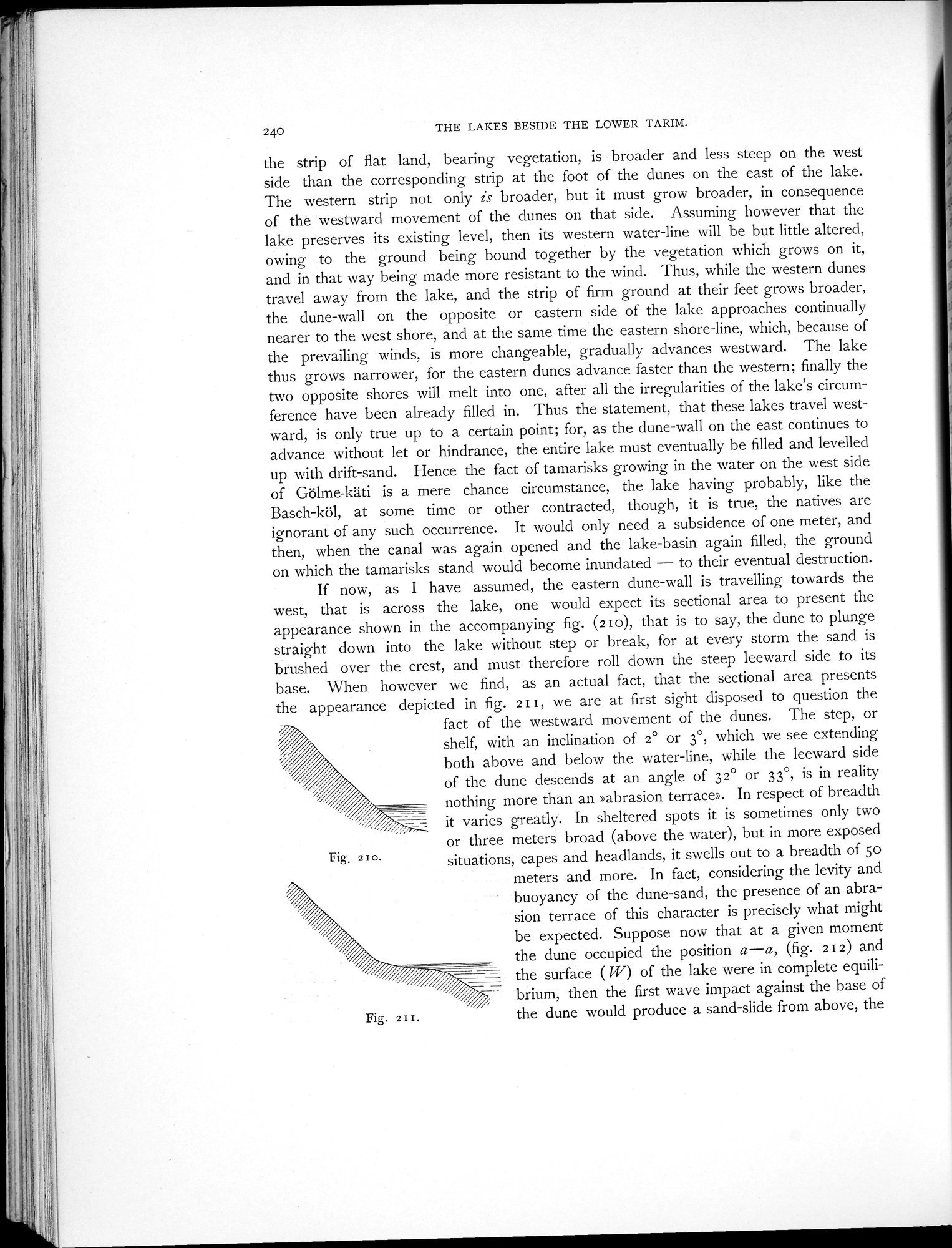
If now, as I have assumed, the eastern dune-wall is travelling towards the west, that is across the lake, one would expect its sectional area to present the appearance shown in the accompanying fig. (2 o), that is to say, the dune to plunge straight down into the lake without step or break, for at every storm the sand is brushed over the crest, and must therefore roll down the steep leeward side to its base. When however we find, as an actual fact, that the sectional area presents the appearance depicted in fig. 2I I, we are at first sight disposed to question the
fact of the westward movement of the dunes. The step, or shelf, with an inclination of 2° or 3°, which we see extending both above and below the water-line, while the leeward side of the dune descends at an angle of 32° or 33°, is in reality nothing more than an »abrasion terrace». In respect of breadth it varies greatly. In sheltered spots it is sometimes only two
or three meters broad (above the water), but in more exposed situations, capes and headlands, it swells out to a breadth of 5o
meters and more. In fact, considering the levity and
buoyancy of the dune-sand, the presence of an abra
sion terrace of this character is precisely what might be expected. Suppose now that at a given moment the dune occupied the position a—a, (fig. 212) and the surface ( W) of the lake were in complete equilibrium, then the first wave impact against the base of the dune would produce a sand-slide from above, the
Fig, 210.
Fig. 2I I.
|
Copyright (C) 2003-2019 National Institute of Informatics and The Toyo Bunko. All Rights Reserved.