National Institute of Informatics - Digital Silk Road Project
| |||||||||
|
| Scientific Results of a Journey in Central Asia, 1899-1902 : vol.1 |
 |
| TYPE OF CANOES ABOUT KASAK-JAJLAKI. |
| FROM INTSCHKÄ TO KORAL-DUNG. | 99 |
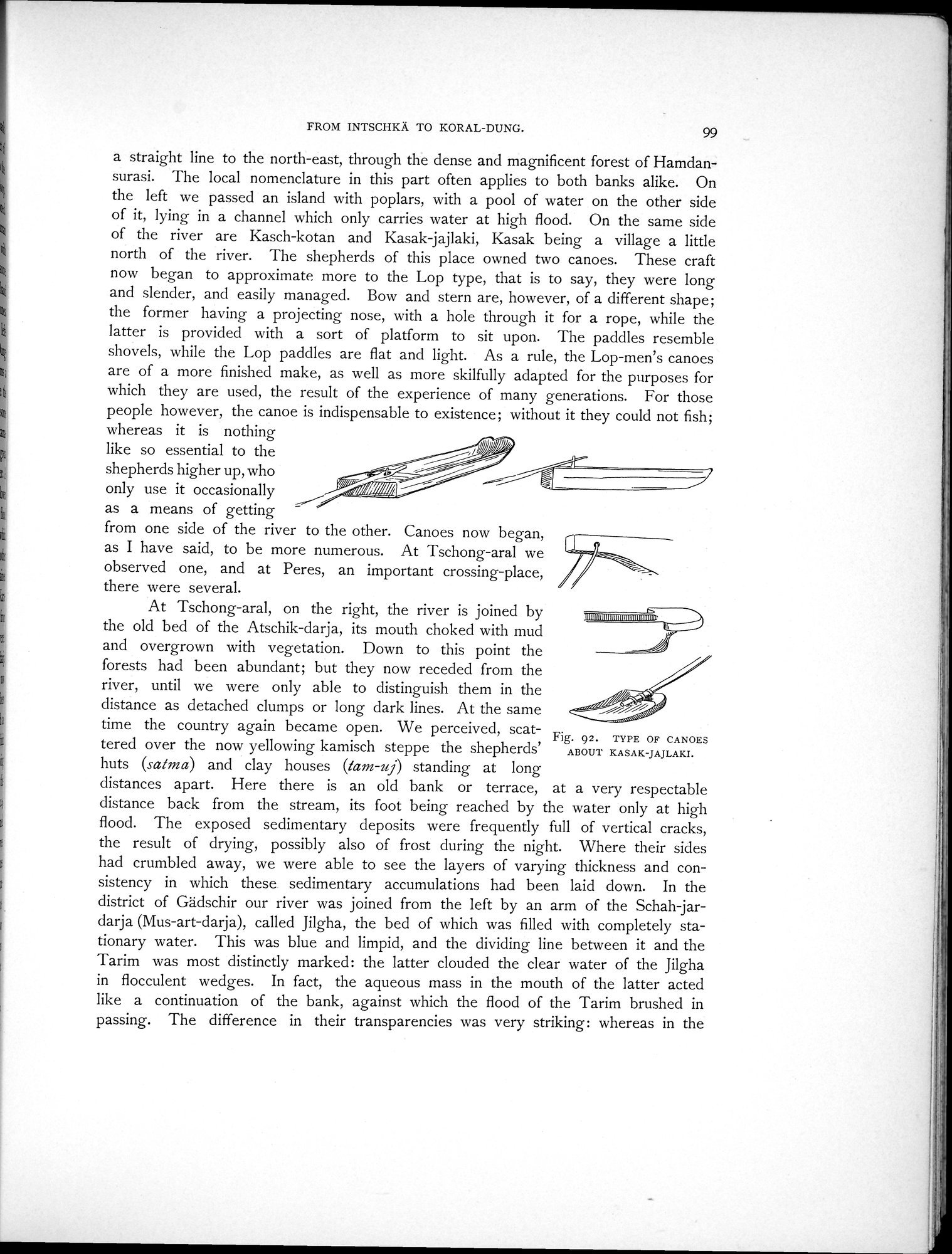
a straight line to the north-east, through the dense and magnificent forest of Hamdansurasi. The local nomenclature in this part often applies to both banks alike. On the left we passed an island with poplars, with a pool of water on the other side of it, lying in a channel which only carries water at high flood. On the same side of the river are Kasch-kotan and Kasak-jajlaki, Kasak being a village a little north of the river. The shepherds of this place owned two canoes. These craft now began to approximate more to the Lop type, that is to say, they were long and slender, and easily managed. Bow and stern are, however, of a different shape; the former having a projecting nose, with a hole through it for a rope, while the latter is provided with a sort of platform to sit upon. The paddles resemble
shovels, while the Lop paddles are flat and light. As a rule, the Lop-men's canoes are of a more finished make, as well as more skilfully adapted for the purposes for which they are used, the result of the experience of many generations. For those people however, the canoe is indispensable to existence; without it they could not fish;
whereas it is nothing
like so essential to the
shepherds higher up, who
only use it occasionally r fill
as a means of getting
from one side of the river to the other. Canoes now began, as I have said, to be more numerous. At Tschong-aral we observed one, and at Peres, an important crossing-place, there were several.
At Tschong-aral, on the right, the river is joined by the old bed of the Atschik-darja, its mouth choked with mud and overgrown with vegetation. Down to this point the forests had been abundant; but they now receded from the river, until we were only able to distinguish them in the distance as detached clumps or long dark lines. At the same time the country again became open. We perceived, scattered over the now yellowing kamisch steppe the shepherds' huts (satina) and clay houses (tam-uj) standing at long
distances apart. Here there is an old bank or terrace, at a very respectable distance back from the stream, its foot being reached by the water only at high flood. The exposed sedimentary deposits were frequently full of vertical cracks, the result of drying, possibly also of frost during the night. Where their sides had crumbled away, we were able to see the layers of varying thickness and consistency in which these sedimentary accumulations had been laid down. In the district of Gädschir our river was joined from the left by an arm of the Schah-jardarja (Mus-art-darja), called Jilgha, the bed of which was filled with completely stationary water. This was blue and limpid, and the dividing line between it and the Tarim was most distinctly marked: the latter clouded the clear water of the Jilgha in flocculent wedges. In fact, the aqueous mass in the mouth of the latter acted like a continuation of the bank, against which the flood of the Tarim brushed in passing. The difference in their transparencies was very striking: whereas in the
-7
umimuuuunouuuuuunu imor■
— ~
.,,_ ,,, gi/i~ i1 ~,
Fig. 92. TYPE OF CANOES
ABOUT KASAK-JAJLAKI.
|
Copyright (C) 2003-2019 National Institute of Informatics and The Toyo Bunko. All Rights Reserved.