National Institute of Informatics - Digital Silk Road Project
| |||||||||
|
| Eine Routenaufnahme durch Ostpersien : vol.2 |
 |
5.4
6.6
4.8
9.2 4.8 10.8 8.4
9.0
5.0
2.6
8.2
5.1
4.5
2.4
1.3
3.9
1.3
1.9
11.2
10.7
8.7
9.7
5.7
10.9
»
»
»
»
»
5500
S 70 0
S 75 0
5670
5750
S 80 0
5370
S 40 0
5300
S 150
2.2
0.8
254.8
6 S 45W 4.2
4 S 10W 0.7
6 S 17W 1.8
2 S 40 0.1
5 S 33W 2.7
1 S 0.0
S 20W
S 60W
S 35W
t
f
Fg
»
,
4.2 F 2/1112s = 155 K. Schr. w 1 k-r ns
3.9 » » » »
5.7 » » » »
2.0 » » » »
4.2 » » » »
1.0 » » » »
S 20 0
0.7
1.9
2
2 S 47 0 1.5
4 S450 2.8
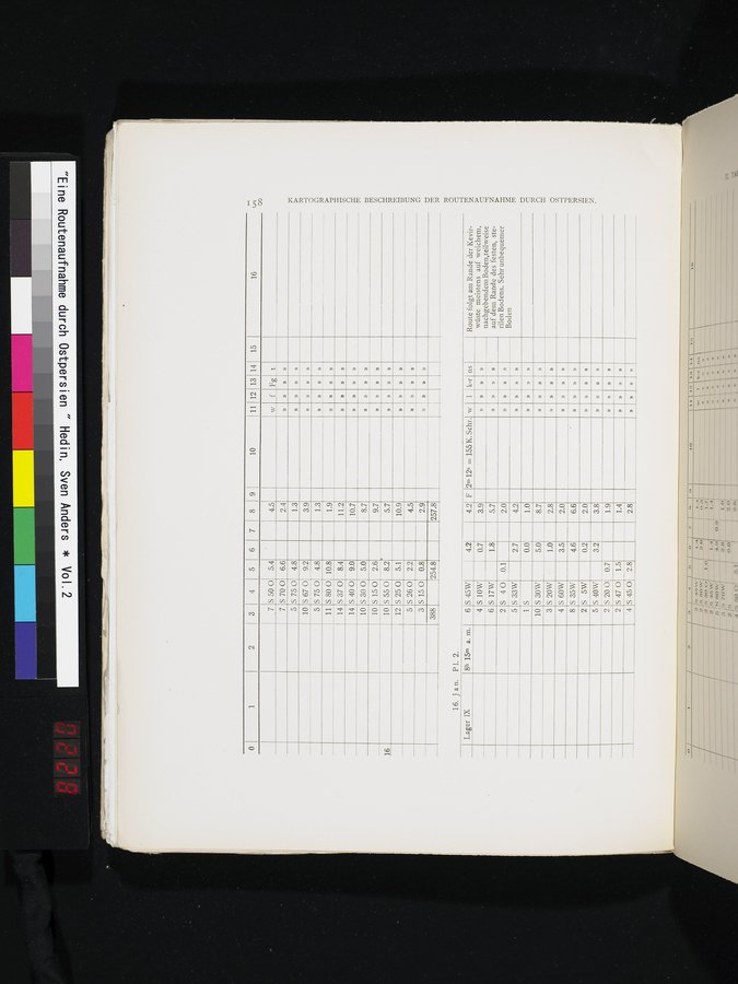
Lager IX
8h 15m a. m.
»
»
10
S 30W
8.7
5.0
»
1.0
2.8
D
»
3.5
2.0
»
»
6.6
4.6
0.2
2.0
»
3.2
3.8
16
16. Jan. P1. 2.
7
7
5
10
5
11
14
14
10
10
10
12
5
3
388
3
4
8
2
5
S 55 0
S 25 0
S 26 0
S 150
S 5W
S 40W
4.5
2.9
257.8
Route folgt am Rande der Kevirwüste meistens auf weichem, nachgebendem Boden,teilweise auf dem Rande des festen, sterilen Bodens. Sehr unbequemer Boden
KARTOGRAPHISCHE BESCHREIBUNG DER ROUTENAUFNAHME DURCH OSTPERSIEN.
1.4
2.8
2
1-1
00
16
8
10 11 12 13 14 15
4 5
|
Copyright (C) 2003-2019 National Institute of Informatics and The Toyo Bunko. All Rights Reserved.