National Institute of Informatics - Digital Silk Road Project
| |||||||||
|
| Eine Routenaufnahme durch Ostpersien : vol.2 |
 |
»
»
»
»
»
»
»
»
»
»
»
»
»
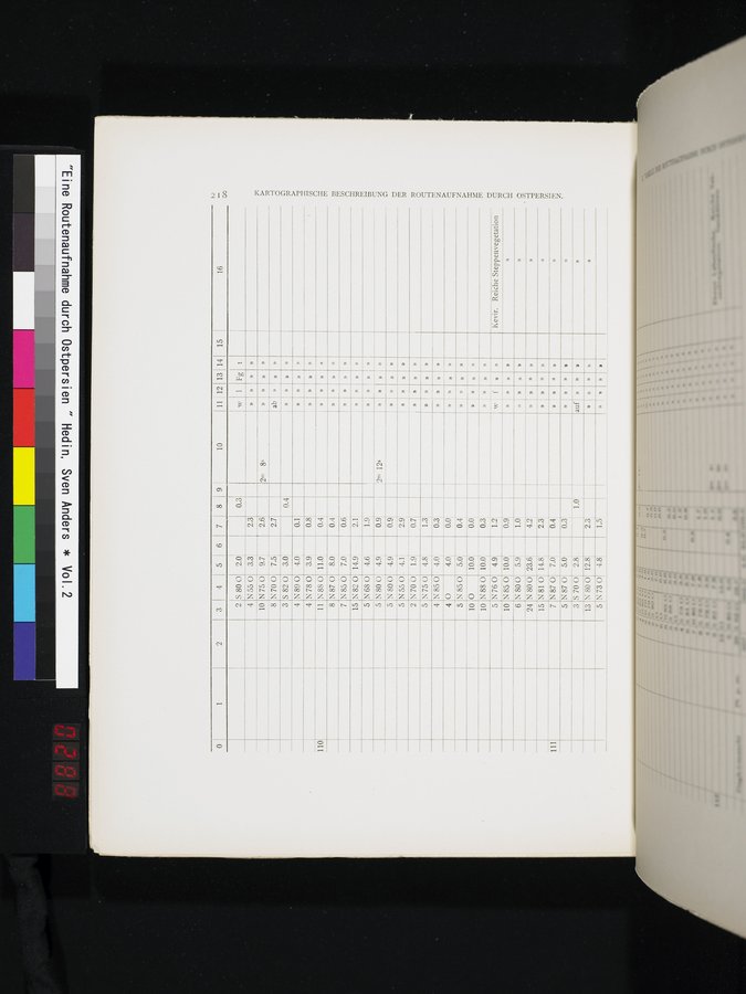
2 3 4 5 6 7 8 9 1 10 11 12 13 14 15
1
16
4 N55 O 3.3 2.3
»
N750
N700
5820
2.6
2.7
0.4
2m 8s
ab
»
N87 0
N85 0
8.0'
7.0
0.4
0.6,
»
5 N680
4.6, 1.9,
N80 0
4.9
0.9
2m 12s
5
4.9: 0.9
5 N55 0. 4.11 2.9
2 N70 O 1.91 0.7
5 N750
N850
o
5
N80 0
4.8
1.3
»
n
»
»
»
4
»
»
N89 0
4.0
»
4
3.9'
N780
»
11.0
110
0.1
0.8
0.4
11 N88 0
4.0
0.3
0.0
4.0
0.4
5.0
5
10.01
10.0
N85 0 O
10
0.0,
0.3r-
N88 0
10
4.9
» » w'f
1. 1
»
10.0
0.91
»
n
5.9
»
»
23.6
4.2
2.3'
14.8;
7.01
»
111
»
»
y
0.4!
0.31
»
»
1.0
2.3
auf »
»
»
5 N760 10 N85 0
6 N800 24 N 80 0
15 N 81 O
7 N87 O
5 N870 5.0, 3S700 2.8 13 N80 O 12.8
Kevir. Reiche Steppenvegetation
» x
» o
))
t~7
cn
»
10
8
3
9.7
7.5
3.0
8
7
N82 0
14.91 2.1;
15
»
4
4
0.3
5
»
2 S 80 0 2.0
w 1 Fg t
N73 0 4.8
»,r »
1.5:
|
Copyright (C) 2003-2019 National Institute of Informatics and The Toyo Bunko. All Rights Reserved.