National Institute of Informatics - Digital Silk Road Project
| |||||||||
|
| Mission Scientifique dans la Haute Asie 1890-1895 : vol.2 | |
| Scientific Mission to High Asia 1890-1895 : vol.2 |
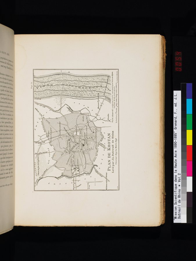 |
| KHOTAN MAP/ Surveyed by J.L. Dutreuil de Rhins/ February 1892 & March 1893PLAN DE KHOTAN/ Levé par J.L. Dutreuil de Rhins/ Février 1892 & mars 1893 |
0
C
Nord man S° N.O.
t ea 0
e
PLAN DE KHOTAN
Levé p ar J.L. Dutreuil de Rhins
Février 1892 '8c Mars 1893
•
Point observé : Longitude 7737'30" Latitude37o7'oo"Altitude137om, résultat de 669 observations
Echel le =„/So.000
so hectometres omitres
if. Clients e
J
|
Copyright (C) 2003-2019 National Institute of Informatics and The Toyo Bunko. All Rights Reserved.